The Geological Zeitgeist
Writing about the history of plate tectonics for the Rock and Sky plate course on the same subject has been a fascinating experience. The images and text in the books does little to bring to life the human drama, the great thinking, the hard work, the voyages of exploration, the money spent, and the attitudes of the day. Marie Tharp, a woman working in a man's world was slighted and accused of 'girly talk', but she preempted many of the so-called discoveries made by some of the big names of the day. Some researchers were also ahead of the game, working on their own projects, little realising the implications of their work and how they had by accident discovered a piece to the great tectonic puzzle. Read on to find out more.

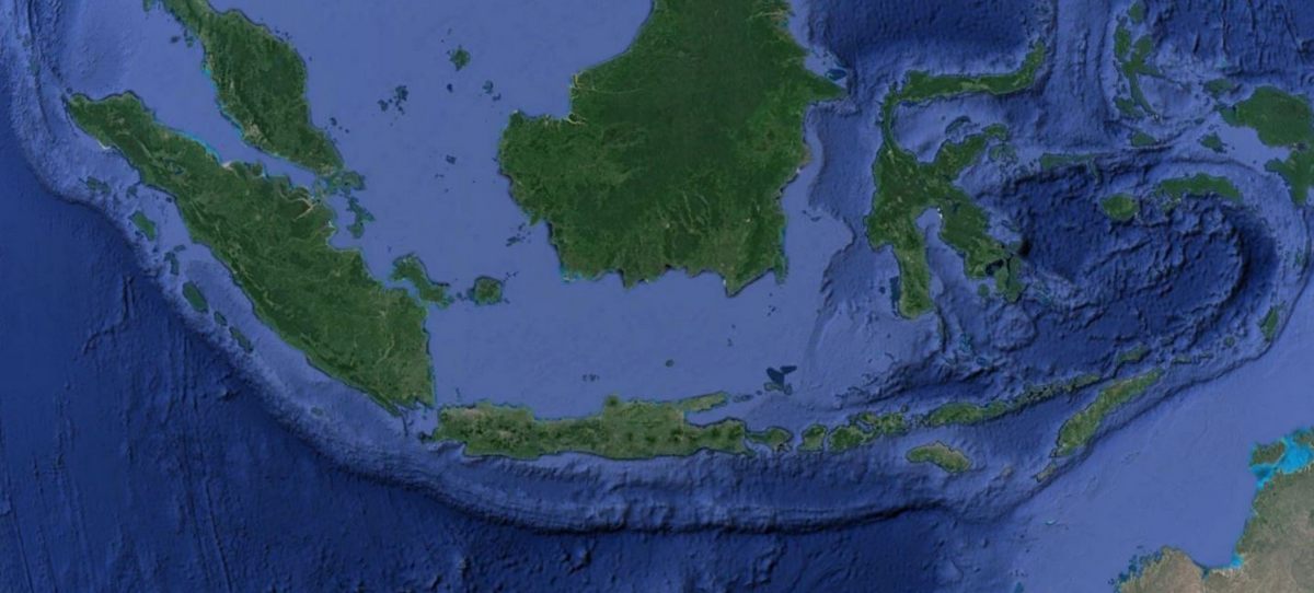
The great foredeep located to the south of the islands of Sumatra, Java, Bali, Lombok and Flores.
I have been wrestling with plate tectonics these last couple of weeks. As part of ‘romancing the stone’ and getting you excited about geology and physical geography I am building a plate tectonics and rock cycle course, but of course steering well clear of the boring text book stuff. Perhaps I should say that I am trying to frame the whole subject, explaining why it is important, and the exciting head days that began in the 1940’s and which continue to some extent today.
The high water mark I guess was 1965 when Plate Tectonics became accepted theory and the lens through which earth scientists and other disciplines came to view the world. It has been a fascinating journey for me – in fact several months ago I put up a YouTube video on the history of the theory – but the more I dig the more information I find, and the more people I come across who all should have a mention in the scientific journals and history books. But some grabbed the lime light, some were thrust into the lime light, and some retreated to the dark abyssal depths where there was some peace and quiet to be had.

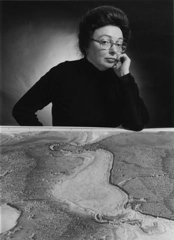
Marie Tharp
What struck me on my wanderings through the internet and through some of the books on my bookshelf was how ahead of the game some people had been. For example Marie Tharp was a geologist and a mapmaker and under Bruce Heezan had plotted soundings taken across the North Atlantic, and confirmed the ridge that ran down the centre of the Atlantic basin. But more than that, she also noted that there appeared to be a rift which ran along the crest of the ridge, and she interpreted that as a rift valley. They knew at the time that new lavas were to be found along the ridge, and she reasoned that the shape of the ridge, the rift valley, and the presences of lava confirmed that sea floor spreading was taking place. Bruce Heezen dismissed this all as 'girlie talk'.

Tharp's map of the oceans
However he did task someone to plot the location of earthquake epicentres in the North Atlantic, and guess what – when the two data sets were compared, it showed that the earthquakes were aligned exactly along the rift which Tharp had so carefully plotted. He became a convert to the idea of plate tectonics, and published papers and maps on his findings. The trouble is, they weren’t his findings, but that of Marie Tharp’s. And not one of those maps or publications had her name on it. In this day and age, we cannot believe that something like that could happen. And besides, she beat Professor Harry Hess to it by at least 3 years – he published a paper in 1962 spelling out his theory of sea floor spreading, but Tharp had realised this anyway – good science, hard work, and probably a good dose of women’s intuition. Tharp did eventually get recognised and rewarded for her work, I am pleased to say. And it was Marie Tharp's work that led to the map of the oceans which we are familiar with today.

Hugo Benioff
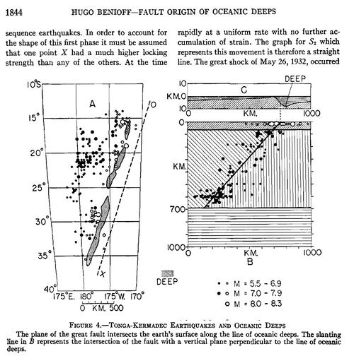
Another great part of this puzzle for me was how they know that crust was being destroyed somewhere. Then it hit home. Part of the syllabus deals with Benioff zones, which is where the tectonic plates are destroyed by subduction. I was fascinated to read up on the work of Hugo Benioff – he published a paper in 1949 where he theorised that the great ocean trenches of the Pacific and South America were the result of faulting. He had plotted the position of earthquake epicentres as well as their depth and found that they plotted as a line which descended below the Andes in the case of South America, or the islands of Tonga and Samoa in the Pacific. He ascribed this to faults that extended deep into the crust. I found the original 1949 paper, which is an interesting read, and it is always lovely to get insights into the zeitgeist of the time.

As the various pieces of the plate tectonics puzzle began to fall into place, it was realised that with the minting of new crust at the spreading centres, there had to be a corresponding destruction of crust somewhere else, and suddenly Benioff’s 1949 paper provided the answer – the crust was being subducted along these deep oceanic trenches, which were indeed faults, and the earthquakes that he had used as evidence for his hypothesis were none other than the juddering of the plates as they descended down into the hot, fiery mantle, to be melted and recycled in a magmatic underworld. When I was at university, we knew these as Benioff Zones, but it turns out that a Japanese seismologist had been doing identical work, but had been publishing his findings in Japanese. I think geologists are pretty good at sharing the glory – there have been a few instances of these kinds of things – and now the zones are known as Wadati-Benioff Zones. Bruce Heezen however was an exception.
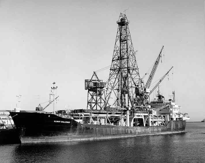
So the development of plate tectonics was an international effort and those were heady days indeed. Many millions of dollars were spent drilling the ocean floor, dating the age of rocks and undertaking sonar scans to confirm the hypothesis that had been presented in the scientific papers of the 1950s and 1960s, bearing in mind that Wegener had also written papers as early as 1912 and Benioff in 1949.

The Glomar Challenger and the Deep Sea Drilling Program - built especially for drilling the deep ocean floor.
I get excited when I read about this stuff, and it is amazing to be able to frame the topic of plate tectonics in this way. If you are interested in the course, keep on visiting us here at Rock and Sky, or even better, sign up to stay informed as we build content and create new courses for you – whether you are a student, learner or teacher.
Note: Your details are safe and we will not be sending dodgy stuff or spamming you. Promise
If this resonates with you and you think it may be valuable to others, please share, and leave your comments in the box below.

