Teaching mapwork is an ongoing challenge. It is perceived to be difficult, boring and possibly irrelevant. I have been thinking of ways to make it more exciting and more accessible to our students. Mapping has been central to a great part of human endeavour and I look at some of those grand adventures as a way of piquing the kid's interest and framing the subject, before we dive into the nuts and bolts of scale, co-ordinates, map symbols and contours. Read on to find out more >>>>

The high Himalayas
I downloaded a paper from the South African Geography Teacher’s Association website. It was titled “Namibian teachers’ perceptions and practices of teaching mapwork” by Naxweka and Wilmot (2019) and it discusses the challenges and issues surrounding the teaching of mapwork. It was an interesting read. I had been thinking about ways to make what is perceived to be a boring and difficult subject interesting and exciting. As always, I started to look for ways to romanticise the topic by introducing tales of high adventure and exploration.
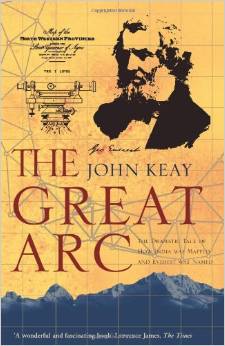
I remember returning from a trekking trip to the foot of Kanchenjunga, Earth’s third highest mountain, and finding a wonderful book called “The Great Arc – The Dramatic Tale of How India Was Mapped and Everest Named” by John Keay. It came to light in the most gorgeous bookshop called Oxford Books and Stationery right on the Mall of Darjeeling in the Indian State of West Bengal. Darjeeling is famous for its tea and three British assaults on Everest during the 1920's. The last attempt led to the deaths of Mallory and Irvine - and they may have reached the summit all those years ago.
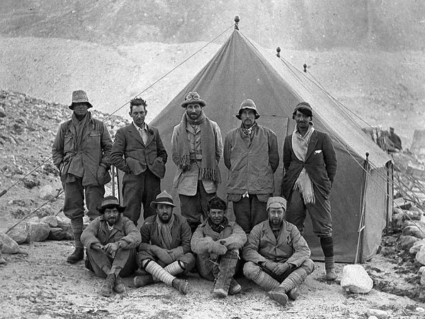
The 1924 Everest Team. Mallory and Irvine died on that 1924 assault on the mountain.
The Great Arc it is the most amazing tale of high adventure across mountains and deserts, swamps and jungles. It is a tale of fortitude, forbearance, professionalism and scientific endeavour in the face of almost insurmountable odds. The Great Trigonometrical Survey (GTS) staff died like flies from disease, wild animals and extreme weather conditions. Out of that great undertaking came the heights of Earth's highest mountains, and the naming of Mt Everest.
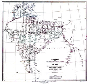
The Great Trigonometrical Survey of India
The GTS was also pertinent to earth scientists thanks to the anomalous deflections of the surveyor’s plumb bobs, which were ultimately explained by the gravity deficiency arising from the massive bulk of the Himalayas. This discovery led to the theory of isostasy. But that is another story which we can’t delve into at the moment.
Now that our interest has been piqued by romantic tales of high adventure, we are in a better position to introduce the nuts and bolts of the subject. The need for maps became apparent when European explorers sailed out onto wild and uncharted oceans and ever since we have been making maps to fix our position in time and place, and to make sense of the world around us.
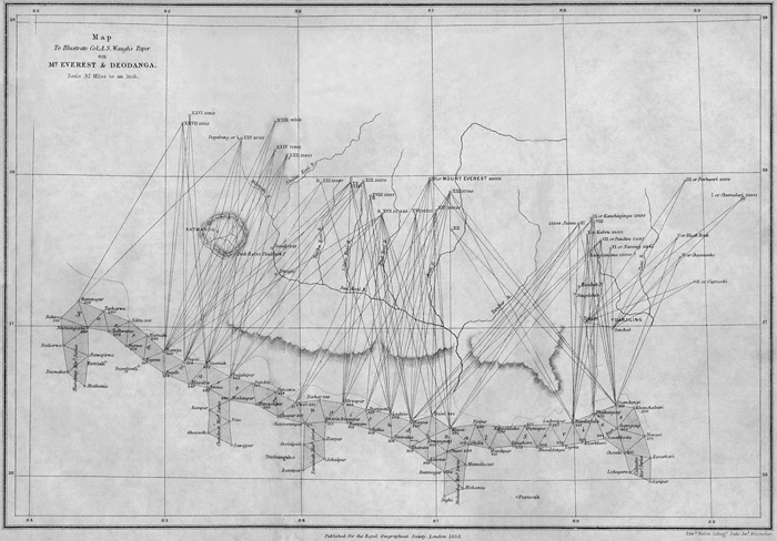
The sightings of the great Himalayan peaks led to the discovery of the highest mountain on Earth
A real-time map of icebergs in the North Atlantic
Maps are immensely useful tools for conveying information graphically. They are ‘written’ in a language which, if understood, provides us with insights into the world around us. If Christopher Columbus had had a map of the North Atlantic and the eastern seaboard of what is now America, his life would have been much easier and less stressful. By the same token, a real-time map of icebergs in the North Atlantic would have helped Captain Edward Smith avoid the iceberg that sank the Titanic. Nowadays pilots rely on aeronautical charts when they fly between major cities and mariners use nautical charts when they make ocean crossings. Geographers, geologists, engineers and town planners use maps on a daily basis.
We can have maps of the Moon and of Mars
So maps provide spatial data – data that relates to our physical world and our position in it. Maps don’t necessarily have to be representations of our Earth – we can have maps of the Moon and of Mars. We have maps of the constellations. We have maps of the Solar System which allows for the planning of interplanetary exploration such as the Voyager space probe that set out to visit the planets in our Solar System. Even pirates had a treasure map to show where the treasure was buried – providing a reference for them on their return, or allowing others to collect the loot for them.
a tale of mountains crossed and rivers forded is creating a map - albeit a verbal one
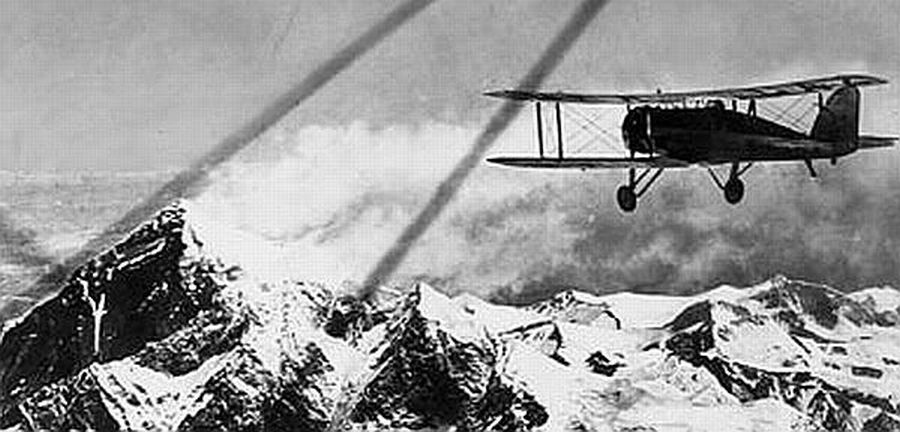
Flying high over Mount Everest
We have seen that a map can provide a great deal of information. Most importantly a map serves to convey knowledge and experience of a place in a very structured way. On its simplest level, someone who has explored a route and returns home to tell a tale of mountains crossed and rivers forded is creating a map – albeit a verbal one. Provide him with a piece of paper and an even better graphical representation will result. Throw in a pedometer or a measuring wheel and the map becomes more accurate. Tape measures or chains pulled across wild territory makes it even more so. Bring a theodolite and the theory of triangulation, supported by a rigorous and systematic approach, and possibly a shed load of money, and you are going to get a very accurate map – a 3D rendering of space.
The cartographers who make those maps aren’t that interested
All maps display a degree of subjectivity depending on the message they are trying to convey. For instance, aeronautical maps intentionally show where all the airports and airstrips are located, as well as the navigation beacons. The cartographers who make those maps aren’t that interested in the location of harbours and presence of treacherous reefs so this information is left off the map. For mariners this information is critical and so nautical maps have a different emphasis to aeronautical maps. Hikers in wilderness areas are more interested in the trails, the location of watering points and the distance to the next overnight hut than they are in the location of a particular rocky outcrop that may on the other hand be of great interest to a geologist. The sketch map you draw to help your friend get to your house will be different to the one that you would draw to show the location of the local supermarket.
The big question is, how do we go about teaching this stuff?
Speaking from personal experience, I remember not being that excited by mapwork back in my school days - in fact it was a big yawn. However, we had the advantage of being involved in Scouting, and so we used maps in 'anger' – 15 km, then 25 km, and then 50 km hikes across unknown country. We had to plan our route, shoulder our packs, and head on out. There was no GPS system back in the day, so we had to orientate the map using a compass, locate ourselves thereon by taking compass bearings on distant landmarks, and then decide which way to go, taking into account the location of cliffs, slopes, rivers and marshland. The hiking was great fun, and those map reading skills proved extremely valuable in the school geography classes - perhaps that is why I used to yawn in the class - we had done this all before.
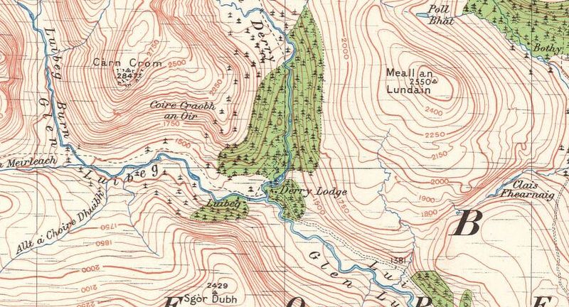
Another valuable exercise we had to do was to make a plane-table map. Plane table mapping harks back to the days when military scouts ranged out ahead of an advancing army. No commander worth his salt was going to send his troops into the field without knowing the lie of the land. So the military scouts went out ahead to reconnoitre and where possible to make maps. And a plane table map was a simple way of doing this – low tech, and remarkably accurate. More on plane tabling and how it can assist you in your teaching in another blog.
We plotted pagodas, ponds and tipping bamboo water features
By making a map – ours was that of a beautiful Japanese Garden at the bottom of our road where we plotted pagodas, ponds, waterfalls and tipping bamboo water features- we had a grip on the concepts of scale, triangulation, map symbols and true north. All wonderful stuff.
That kind of answers the big question
I guess that kind of answers the big question. For us, map work was framed by the Scouting experience, augmented by the fact that we were sea scouts, which gave us access to nautical charts and some basic concepts of celestial navigation, bathymetry, navigation aids and nautical symbols. All impossibly exciting for a 15-year-old kid.
Rope in our dear friend, the maths teacher
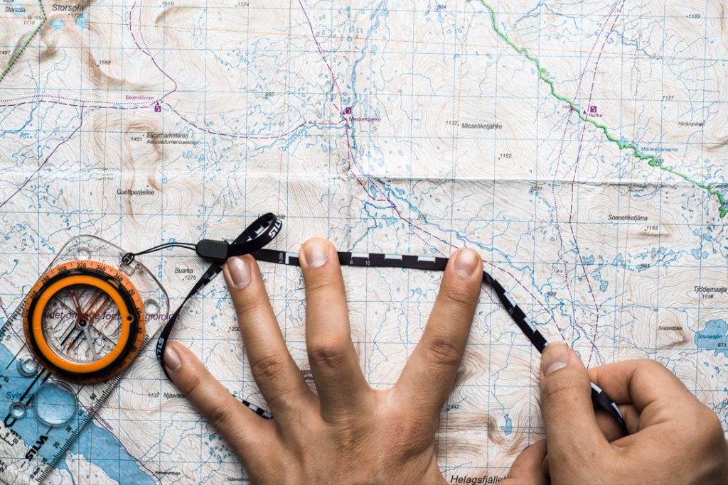
I believe that by making things a little more practical by getting the kids to make their own maps this will ensure that they grapple with the concepts in a very real way. Orienteering exercises where they have to navigate from one point to the next with a map and compass may also be exceedingly useful exercises. As an aside it may be useful to rope in our dear friends, the maths teacher and the physics teacher, to talk about scale, ratios, vectors, gradients and gravity in their classes.
Quoting from the 2019 Naxweka and Wilmot paper, it was “found that the student teachers struggled with basic mathematical calculations, experienced problems with reading and interpreting maps and could not identify slopes and landforms on contour maps…Studies done in Europe found that the difficulties encountered by students when reading and interpreting topographical maps may be attributed to teachers’ inability to properly handle components of teaching mapwork skills (Reinfried, 2001). According to Bednarz et al. (2006) when teaching mapwork, teachers tend to teach map skills by focusing on the content of the map. As a result, too often, learners are able to give an account of the map but lack the ability to interpret the content and the geographic impacts illustrated by maps (ibid.).
A similar finding emerged in McCall’s (2011) study, with mapwork teaching focusing on “teaching factual details without requiring students to understand map and spatial concepts such as why places are located where they are, or reasons for their physical and human characteristics.” Another Nigerian study found that concepts learners find difficult in mapwork are the same as those which teachers find difficult. This includes, for example, gradient, inter-visibility, latitude and longitude (Amosun, 2016). The research found that inappropriate teaching methods may be a contributing factor to poor performance in mapwork. The study also found that teachers are scared, and often avoid teaching mapwork because it is sophisticated and requires abstract thinking and mathematical skills (Amosun, 2016).
In summary, it would appear that there is:
- a poor mathematical ability on behalf of both teachers and learners
- an inability to read and interpret the maps
- no requirement to understand map and spatial concepts as to why places are located where they are.
- there is too much focus on map content rather than interpretation of content and the geographical impacts illustrated thereon
- Inappropriate teaching methods
- Teachers are scared by the need for abstract thinking and mathematical ability.
Fundamental in being able to pursue my profession
Being able to make, understand and interpret maps is a fundamental skill. From a personal point of view, that grounding in mapwork which I got through scouting, school and then at university has stood me in good stead – in fact it has been fundamental in being able to pursue my profession as a geologist. We cannot afford to neglect the teaching of these skills, for many professions rely on them – with obvious examples including geographers and cartographers, but also earth scientists, architects, town planners, engineers, environmentalists, soil scientists, agriculturalists and explorers. This is by no means an exhaustive list.
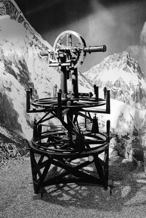
One of the huge theodolites used in the mapping of India
The mathematics is not difficult
I am of the view that the mathematics is not difficult, and if the kids are coping in the maths class then they will certainly be able to cope with the concepts of scale and some simple trigonometry. Interpretation of why things are the way they are can be subjective, so that may be a little trickier to address. All sorts of factors come into play – historical, social, geomorphological, geological, climatological, environmental, and all we can hope to do is to provide the lens which the learners can use to interpret the maps. The issue of inappropriate teaching methods can be addressed by actually getting the kids to make their own maps, or use maps in ‘anger’ so to speak by navigating across country, or plotting the route of rail line or road, or planning the layout of a town. And once everyone has jumped in it will not be as bad as we thought it would be, the fear will evaporate and the sense of mission will take over. And I will be here to guide you along the way.
How we can address the challenges
Please leave your comments in the comments box below - it would be great to hear about your pain points, your own experiences, and your ideas on how we can address the challenges of teaching what could be one of the most interesting aspects of the subject.
Don't Miss Out
We are building out dedicated courses on geographical topics to assist you in the classroom, one of which will of course be mapwork so if you are interested in hearing more about this, please leave your details in the contact form below so that we can keep you updated on developments and launch dates. Your feedback will also be appreciated as this helps us tailor the course to your requirements - which of course is advantageous for us all.
If this resonates with you and you think it may be valuable to others, please don't hesitate to share.
Want to know more on how Rock and Sky can support you in your teaching endeavours? Of course you do. sign up for our newsletters and stay informed when we launch new courses or head on out on geographical adventures.
A promise - no spam, no nonsense, no passing on of your details
So looking forward to exploring with you


Gerald – I love this piece and your curiosity along with your commitment to finding a way to make Mapwork more exciting. The challenge I see is the insane technology now available to show people where they are on a “google map” or similar. The default now is to use the tech instead of our amazing brains to orient ourselves in space and time. For me, what is exciting is the prospect of “getting back to nature” and disconnecting ourselves from the modern tech in order to fully embrace “the Map” as a way to connect, orient, and embrace “where we are” on this incredible planet and notice what is around us. Finding a way to invite people into an “adventure” where their own survival will depend on a map and a compass and each other, without any tech aids, will bring online the brain function required to “come alive”. The idea of teaching versus learning may be worthwhile exploring as well. Do we frame the exercise as a “teaching” experience or as a “learning experience”? Why would I need to learn something that I have no connection to if I have the tech to give me the answers without even thinking or being connected? You have created a wonderful topic for exploration that I think is best served by asking a question like; So what will we do when the power goes out and we need to get from point A to point B and our very survival depends on it? An awesome low-tech board game would be sensational for those who cannot actually simulate an experience in nature.
Greg. Wow, that’s a long comment. Thank you for taking the time to reply. I seem to have struck a chord with people as my analytics have gone through the roof. Yes, I mostly drive to new places after a quick look at Google Earth and some measurements to tell me when I need to look for the turn off. I occasionally use the Navigator when I get lost, but I hate it, because somehow I don’t seem to be able to build up that spatial map in my head, so if I have to travel that route again I actually cant remember that well the route I took. And I think that I am not the only one who feels like this. Those who never had to navigate using a map and compass or any of those old methods don’t realise that there is something missing.
I also like your comment about the ‘learning experience’ as compared to the ‘teaching experience’. And I think that is what I am trying to say based on those scouting experiences that we had as kids. We learned to do things out of necessity, and those learned skills have stood me in good stead for many years now.
I get where you’re coming from. Like all of us, students are purpose-driven. Knowledge for knowledge sake is only valued by only a very few. Those self-motivated students will gobble up just about anything. So, it’s not them we need to address; it’s the apathetic, less-motivated students, many of which respond best when there is a relatable goal in front of them for the work they are about to undertake, and, better yet, a prize (tangible or intangible) to entice them further.
Map work, for many, has little purpose since it is “all done for them” with gMaps, gEarth, trails apps and a dozen other sites with maps ready made and navigation just a few taps away. I find “fictional adventure” works for younger students (KS2 and up to Yr 7 or so or grades 3 to 7 or 8) and “the syllabus” works for most Sixth Form (DP, AP, A level, Gr 11/12) students. It’s the less-motivated, more academically apathetic KS 4 (Gr 9/10 give or take) students that, for me, pose the greatest challenge.
The other challenge I see is the highly-urbanized, never-seen-nature group of students who have.a very different concept of space, distance, topography, and purpose then those who have been in the outdoors, such as with scouting. As well, many students have been so protected and catered to in their growing up that they have never learned the street skills many of us grew up with and take for granted; for example, something as simple as taking a bus. (First -hand experience tells me this problem is much more prevalent in North America than in Europe.)
So, the challenge you have identified is even more extensive, but not insurmountable. After all, mathematics teachers (and here in Canada, French teachers) have faced this challenge their whole teaching career: how to make something that is irrelevant to their students, interesting, or better yet, fun, and maybe even exciting. Ahhh, the “magic bullet”, the “magic elixir” of teaching. I’ve always believed that if education could be “gamified”, many of my students would be attaining top grades. I say it in jest, but there is a kernel truth.
Thanks for posting this. I look forward to reading about how others have successfully bridged the gap of apathy and disinterest that exists in education.
Terry – you have been enjoying yourself. Thank you for the long and considered comments. I do believe that if we can introduce the ‘fun’ element into the classroom then you are half way there. Perhaps 90 percent there. So yes, urbanised kids are perhaps disconnected from their environment, but everyone loves a treasure hunt or an adventure so we need to somehow integrate those kinds of things into the teaching curriculum. Harking back to our student days, two days in the field were worth hours and hours of lectures in the lecture theatre. I know field trips come with challenges and are expensive and hard work, but I do believe that micro-adventures in the school grounds or in a laboratory can be equally as informative. And perhaps one can co-opt the unmotivated kids to become the champions of a particular project.
It’s all food for thought – so glad that we are having the discussion here.
Interesting and perceptive read. Like you, I developed my map reading skills outside the classroom. In my case by belonging to the Boys Brigade and being deposited in a field in the middle of nowhere and then with a top map finding a way to reach a destination over a given time (often a weekend, carrying tent/food for two nights). My issue with teaching mapping is that students fail to see the relevance, the curriculum does not provide time to teach it in depth and like anything, if students do not continue to hone the skills it has to be taught all over again the following year.
Stephen. Thank you for your reply. Yes, I remember all of us being blindfolded, bundled into a car, which they then drove a couple of times around a roundabout to disorientate us properly, and driven out into the wilds and dumped. So we had to find our location, and from there work our way back. Good fun and good lessons in that.
Time always seems to be the issue here. Perhaps we need to think about doing the practical side of things as a fun extra curricular activity – and market it as something worthwhile attending on a Saturday morning, or during the school holidays.
Much of what we are taught appears irrelevant when we are of school going age. Only later do you realise how important it is, so we shouldn’t be discouraged by that.
A great overview of many issues around teaching mapwork! I like the historical elements and I wonder if you have read ‘Longitude’ by Dava Sobel? It tells a great story about the struggles of making a clock that could measure time on board ship in order to calculate longitude.
Richard. Thank you for your comments and feedback. I have read “Longitude” – all those kinds of books are so fascinating – who needs fiction when the non-fiction stuff is so full of drama and twists and turns. Hopefully you find some time to read some of our other blog posts.
A really interesting and inspiring read! Teaching map skills is so dry but you have really given me food for thought on how to make it more ambitious and full of cultural capital, thank you!
Thanks Rach. Glad to have been some help – I am trying to avoid being the slave to the syllabus and bring other influences and ideas into the teaching arena to try and make it all so much more engaging. Looking forward to the ongoing conversation. Don’t be a stranger here – and while you are here please have a look at some of our other blog posts.