The Eruption of Mt St Helens - Forty Years on
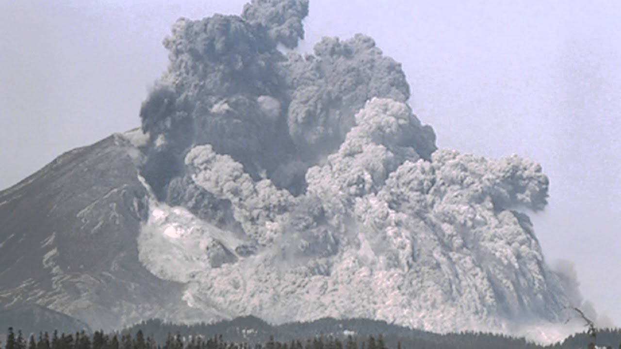
The eruption of Mount St Helens took place on the 18th May 1980. Forty years on, we take a daily look at the happenings that led up to that catastrophic event that killed 57 people and laid waste to hundreds of square miles of property and wilderness.

There had been ongoing earthquakes, beginning on the 15th of March which had alerted the US Geological Survey that something was happening at Mt St Helens. Geologists and volcanologists headed to the mountain, set up their instruments, telescopes and cameras and began to monitor the mountain. During the month of April and early May they recorded the growth of a bulge – a 2.4 km section of the mountain’s north face – which grew outward by 80 m, and during that period it grew between 1.5 m and 1.8 m per day, pushing northward like a mouse under a rug.
No one could go into the bowels of the Earth and take a look
As the bulge pushed northward, collapse took place behind the bulge along faults to form a graben – a downthrown valley of rock, indicating that some kind of void was forming behind the bulge. Magma, pumping into the magma chamber below, was assumed to be pushing northwards, but of course no one could go into the bowels of the Earth and take a look. On May 7th eruptions began to take place, along with thousands of earthquakes, and geologists warned that there was a danger of the bulge sliding and triggering an eruption.
Things weren’t going to go quite the way everybody expected
They continued to monitor the mountain, I guess with a degree of excitement because events like this didn’t just happen every day on the continental United States. But it turns out that things weren’t going to go quite the way everybody expected, so stick around as we continue our story of how the mountain continued to bulge and eventually erupt. Luckily, we are separated by both time and space - 40 years in fact, and therefore safe enough. At least from volcanoes anyway.
His theory lay on the fringes of orthodox thinking for exactly 50 years
The operating system behind the eruption was plate tectonics. Ever since geologists began to explore, examine and try to understand the workings of our planet, they were puzzled why rocks were folded, faulted and distributed the way they were. It took a non-geologist - in fact a meteorologist - called Dr Alfred Wegener to come up with a theory for the distribution of the continents and oceans. He wrote a book on the subject in 1915 which was not well received by the geological community for a host of different reasons, the least of which being that he couldn't come up with a mechanism for continental drift. As such his theory lay on the fringes of orthodox thinking for exactly 50 years. Hard evidence however breathed new life into his ideas and Plate Tectonics, as the theory is now called, is central to the Earth Sciences - it is the lens through which all geologists, and by extension geographers and biologists, view the natural world.
The older crust on the eastern side of the Pacific plate is subducted
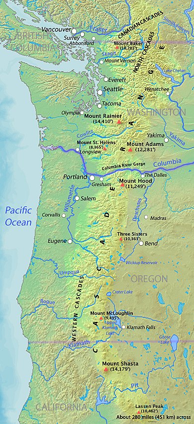
That said, let us return to Mt St Helens. The Pacific plate, which lies off the west coast of the USA, is being driven eastward by the formation of new ocean crust at the spreading centre thousands of kilometres to the west. The older crust on the eastern side of the Pacific plate is subducted below the coast of British Columbia, Washington and Oregon. California is a special case where a complex array of faulting, including the San Andreas Fault, leads to an active earthquake zone which we will look at in another post.
When sufficient pressure builds up eruptions take place.
Today let us concentrate on subducting oceanic crust. We have established that the Pacific plate is diving below the lighter continental crust of the western US. In so doing, it melts at depth to form large diapers of magma. Just like a lava lamp, these diapers rise up through the crust, and in some instances make it almost to the surface. Magma chambers form, and when sufficient pressure builds up eruptions take place. And this is what happened at Mt St Helens.

Thanks Wikipedia
It is not just a story of deep seated tectonic events, but a story of human drama, destruction, good luck and heroism. So stick around for the next episodes - we are on a countdown to the 18th May and a mega eruption.
Look out for Episode 2 of this drama. I will put a notice on the Rock and Sky Facebook page on updates so head on over and give us a like and we will send you a notification.


What a great story – looking forward to the next installment.