Mt St Helens turns 40 today

It’s a Sunday morning at Coldwater II, the monitoring station on the north side of Mt St Helens. By all accounts it is going to be a beautiful day. Volcanologist David Johnston was up and about doing his thing because Mt St Helens had woken up in March and had been rumbling and grumbling for weeks now.
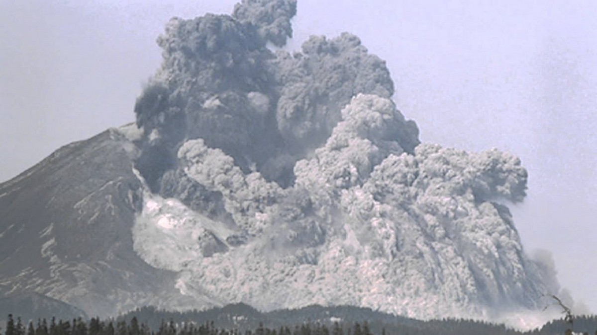
At 08:32 an earthquake of magnitude 5.1 took place, and all hell broke loose immediately thereafter. The northern bulge, which had been growing at a rate of nearly 2 m per day, along with the summit of the mountain, slid away in the largest debris avalanche ever recorded. It was like taking the lid off the over pressurised soda bottle, causing a small dark plume of ash to erupt from the exposed face, and another plume to belch from the crater at the top of the mountain. If you remember from the previous article, there was a cryptodome of hot magma deep in the mountain, pressurised from below due to the subduction that was taking place deep in the Earth’s crust. With no lid to the cryptodome there was immediate depressurisation which triggered a massive eruption – more a blast – that punched northwards through the debris slide and the remnants of the original crater, taking 300 m of the upper cone with it. It has been estimated that the pyroclastic flows from the blast attained speeds of up to 480 km/hr.
Note: For the two earlier episodes dealing with the run up to the eruption, please read here and here

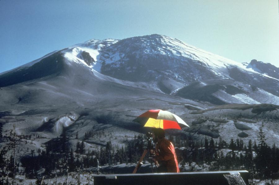
The bulge on the north side of Mt St Helens.
Reference https://volcanoes.usgs.gov/volcanoes/st_helens/st_helens_geo_hist_99.html
In the initial blast, pyroclastic flows comprising hot molten debris, reached the Coldwater II station in seconds. David Johnston was monitoring the mountain. His last message back to the USGS colleagues in Vancouver was “Vancouver! Vancouver! This is it!” The radio then went silent. In spite of several attempts to find him after the eruption, his body was never found. Another brave man to die was amateur radio operator Gerry Martin who was located north of Johnston's position. He reported the ongoing events of the eruption, and as he watched the pyroclastic flows overrun Johnston's position, Martin announced solemnly that: "It's gonna get me, too," before his radio went silent.

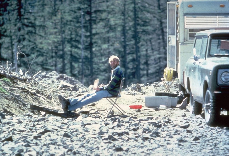
1980-05-17 David Johnston at Coldwater II, 1900 hours, May 17, 1980. Dave did not survive the next day's eruption. Coldwater II would eventually be re-named "Johnston Ridge" in honor of Dave. (Harry Glicken / USGS)
Fifteen minutes after the first lethal blast that killed Johnston and Martin, a cloud of tephra was towering 24 km (80 000 ft) above the mountain. This Plinian type eruption is characterised by a towering column of ash that then spreads horizontally at altitude, raining debris on everything and everyone in its path. It is estimated that the eruption reached its peak between 3 pm and 5 pm that afternoon.
Other volcanologists were on the mountain that day. James F. Fitzgerald was doing his Ph.D. and as a result was camped on Spud Mountain, a few miles northwest of the volcano. Trixie Anders was also working on her Ph.D., and along with her husband Barry Johnston were on their way up to Jim’s camp that morning when the mountain erupted. Fitzgerald died in the eruption, and Trixie and Barry barely made it out alive. Bob Kasewater and Beverly Wetherald were amateur volcanologists who were operating a seismograph at Spirit Lake and it was Bob's photographs of the mountain that allowed scientists to piece together the sequence of the eruption after the event. They were both buried in the initial avalanche in spite of having the car ready for a quick escape.

The avalanche that led to the initial eruption swept down and around the ridges to the north, and in places climbed those ridges. Then it turned westward down the North Fork Toutle River, carrying everything in its way.
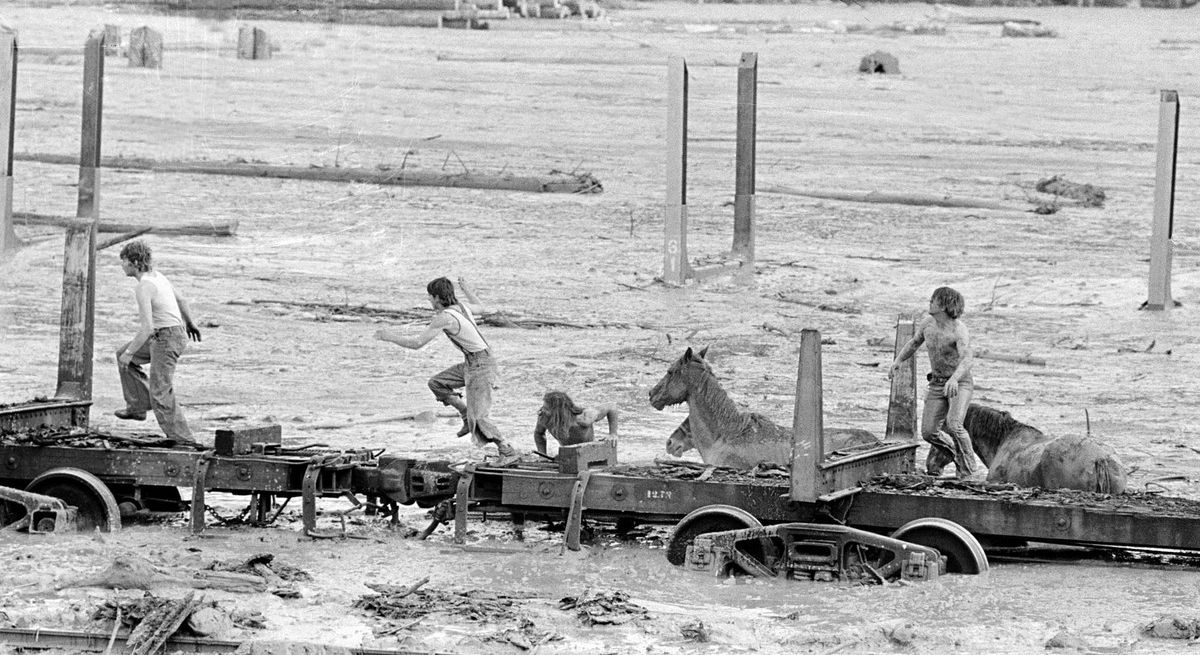
The hot pyroclastic flows then melted the ice and snow on the mountain which released millions of cubic metres of water, saturating debris, which then flowed down the same valleys, wreaking destruction in its path. There are some amazing pictures of brave men trying to rescue horses in the rising tide of mud and water, before they themselves had to run for their lives. These lahars, as they are known, are one of the many geohazards associated with volcanic eruptions. Sometimes they are also triggered by massive amounts of rain from storms that are generated due to an eruption.

Bob Brown, right and John Brown, are shown May 19, 1980 climbing onto railroad car, center, heads down the train along with two additional would be horse rescuers, giving up their efforts as they flee for their lives as flood waters from the Toutle River begin a sudden rise. All four people reached safety but the horses are presumed to have drowned. (AP Photo/Gary Stewart)
At the end of the day 57 people were dead, 600 km2 of forest area had been levelled, and bridges, houses and property had been destroyed downstream of the mountain. Prevailing winds carried 520 million tonnes of ash inland across the US, enveloping the town of Spokane in darkness 400 km distant and dumping huge amounts of ash on central Montana. Some ash even made it to the Great Plains 1500 km away. Fifteen days later there were ash fallouts around the entire globe.
Plate tectonics had been doing its work, subducting the Pacific plate below the North American plate. The descending slab had melted and formed a magma chamber below Mt St Helens, which blew its top on the 18th May 1980. Destruction and death was the result, and it is was a sobering reminder of the power inherent in these earth processes, and how little we as humans can do about it, except to stay away or otherwise count the cost and bury our dead.
Note: For the two earlier episodes dealing with the run up to the eruption, please read here and here
A Special Request
If you enjoyed this account of the 40th anniversary of the eruption, please share it with friends, family and colleagues - the more the merrier.
Leave a comment too please - it is wonderful to get feedback on our endeavours as we try to bring you all sorts of stories on geographical subjects.

