I found myself in the Bazaruto Archipelago - five islands which make up a marine park lying off the coast of Mozambique. It is stunningly beautiful, full of history and impossibly romantic. The geology is fascinating, harking back to the end of the last glacial maximum and subsequent melting of the ice caps. Read on to find out more>>>.
Bazaruto Archipelago from the air. Image courtesy of SunSafaris.com
Stretching out to the horizon was the most beautiful view of emerald islands, aquamarine waters of various hues, and white sand. The channels between the islands run deep and blue, flanked by lighter sand-banks and intertidal areas. Dhows, tiny at this altitude, ply between the islands or lie at anchor over the abundant fishing grounds.
Coconut palms and thatched houses
"Cabin crew, please take your seats for landing” comes over the intercom, and the views of islands and ocean soon changes to coconut palms and thatched houses flash by, before we touch down on the silvery grey tarmac and taxi to the white airport terminal.

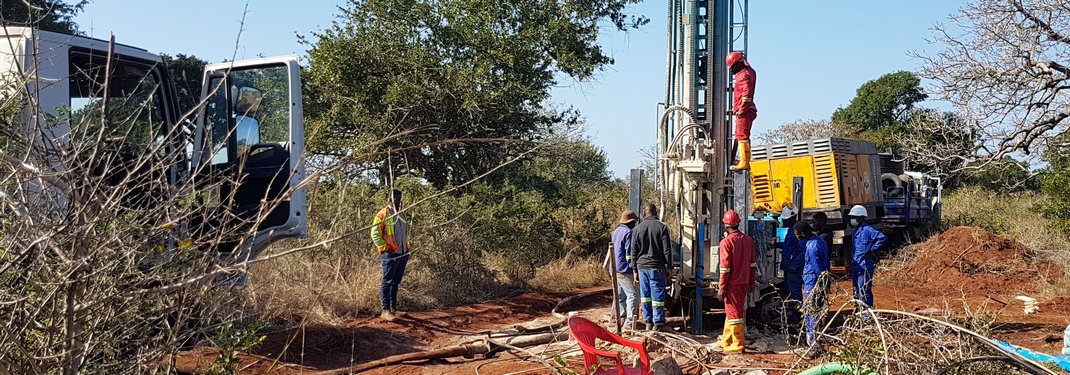
Drilling in the bush
I have just spent 3 weeks in Mozambique on a drilling project. We had the privilege of staying in the most beautiful lodge on the edge of the Indian Ocean, with views out towards the Bazaruto Archipelago. Which were very fine views indeed. Each day was beautiful, and when I could I would tumble my sleepy head out of bed and walk the 100 metres down to the beach to watch the sunrise. Each sunrise had its own special charms, with one standing out in particular – a crescent moon hanging low over the sea, the sky still full of stars, and the eastern skies burning ever brighter before the shimmering orb of red heaved itself over the horizon.
It was declared a marine reserve in 1971
Geography is always on my mind. The geography of places – locality, geographical coordinates, the local languages, the climate, the weather, the prevailing winds. However, apart from all of those things, the dominant feature of where I found myself is the Bazaruto Archipelago, which is what I want to talk about here. Five islands make up the archipelago – namely Bazaruto, which as the largest island, covers 12 000 Ha, then Benguérua at 2500 Ha, Magaruque at 600 Ha, Santa Carolina at 500 Ha and finally Bangué at a diminutive 5 Ha. The Bazaruto Archipelago National Park, for that is what it is, was declared a marine reserve in 1971.
Sea levels were this high 120 000 years ago during the last interglacial period
From my wanderings up and down the South African coastline, and diving trips to Zanzibar, I knew vaguely that the islands were the result of sea level fluctuations in the recent geological past. An internet search pulled up a paper called “Geological evolution and palaeoenvironments of the Bazaruto island archipelago” by Botha et. al (2008)*. It turns out that the sea levels rose 2 metres higher than present around 7000 years ago due to post glacial melting. The last time sea levels were this high was 120 000 years ago during the last interglacial period.

No one is quite sure how barrier islands form. The current theory is that they form during periods of stable sea levels, and emerge from the ocean due to wave action. Once the islands are exposed, additional sand is added due to tidal currents and wave action, and wind also begins to transport sand around the islands, forming sand dunes either perpendicular or parallel to the prevailing winds.
Calcium carbonate is the major component
Shell fragments are also transported by the wind and tides. Rain water, which is slightly acidic, percolates down through the dunes, dissolving the calcium carbonate out of the shell fragments as it goes. When the rain water meets the alkaline sea water, which of course lies at depth, the calcium carbonate is precipitated out, cementing the grains together to form beach rock. As you well know, calcium carbonate is the major component of building cement, and is no less effective in cementing sand particles together as it is in holding our buildings up.

Wind-blown sand dunes
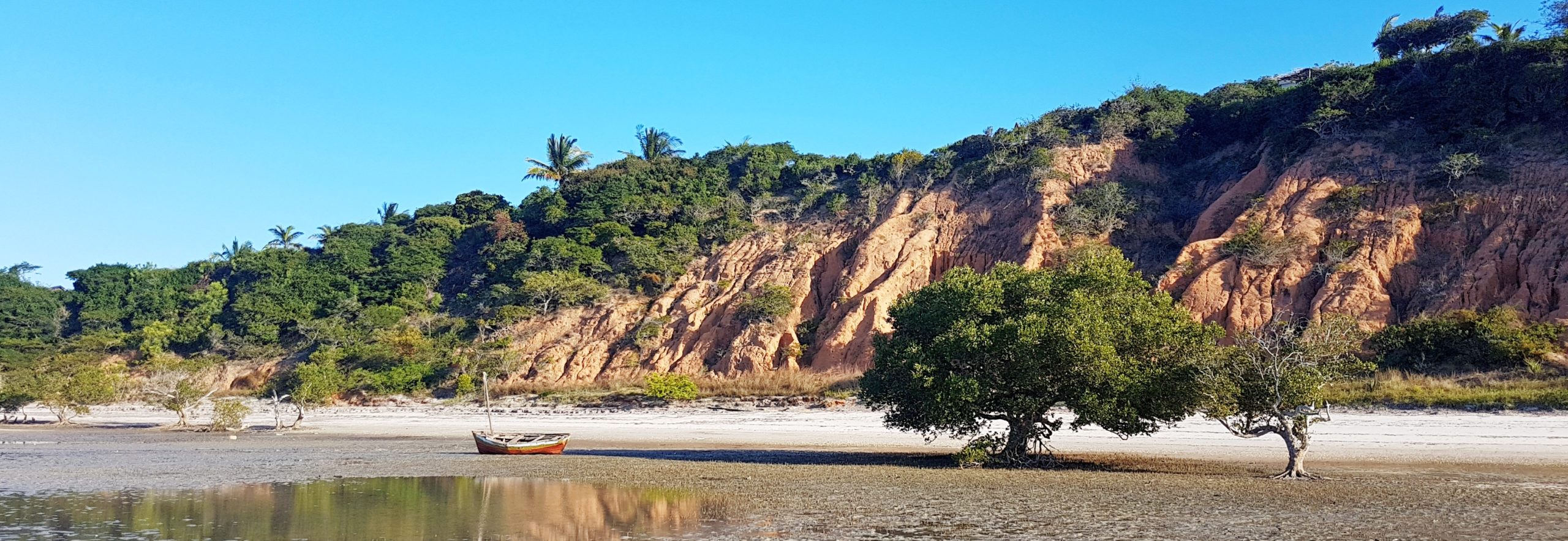
This beach rock forms just below the low tide mark. Where beach rock occurs at different levels within the geological record, you can be sure that fluctuating sea levels have been the cause.
As I walked the beach at Vilanculos, there was no shortage of beach rock to tear my boots to shreds, with wind-blown sand dunes sitting directly on top of this hard, armoured beach.

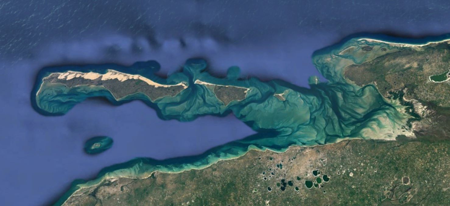
Satellite image of the archipelago. North is to the left.
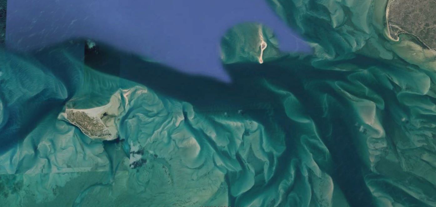
Out beyond the islands lies the Indian Ocean. The warm Mozambique Current flows languidly southwards, fed by tropical surface water of the Equatorial Current. Flying over the islands, and for that matter flying into Vilanculos, one cannot help being struck by the amazing patterns made by the currents in the bay. These are a sedimentologist’s heaven, for the relatively high tidal range of 3 m, reaching in excess of 4 m during equinoxes, leads to the development of strong currents in the channels between the islands and between the coast. These currents build out the flood and ebb-tidal deltas which can be seen from the air and which give the entire place that tropical island feel.

Zoomed in satellite image of the tidal channels. North is to the left.
The prospect of fieldwork in such a beautiful place cannot be denied
Now if I were a hot-shot geologist, ecologist, or anthropologist looking for a place to carry out some research, then Bazaruto would have to be at the top of the list. It is a tropical paradise – warm ocean, palm-fringed beaches, wooden dhows, an impossibly romantic history, with fresh fish and cold beer to round up each day. Scientists are human beings after all, and the prospect of fieldwork in such a beautiful place cannot be resisted. Who wants to be sampling soils in some less-than-pretty backwater when you can be riding out to the islands in a dhow or flying high over the crystal-clear waters of the archipelago on the way to another day of fieldwork?

Arguably the best fieldwork base on Earth.
And the final word on the matter is this – if you want to be able to do that kind of work, then you have to sign up for such wonderful topics as geography or biology and start building a career to that end right now.
Sticking around here at Rock and Sky will also assist you in getting to such wonderful places as we build out our courses and tell stories of wonderful adventures in wonderful places.
*Botha, G.A, Armitage, S.J and Duller, G., 2008. “Geological evolution and palaeoenvironments of the Bazaruto island archipelago” https://www.researchgate.net/publication/261674775
Sign up to stay informed when we launch new courses or haul you along on wonderful adventures.
A promise - no spam, no nonsense, no passing on of your details
If this resonates with you and you think it may be valuable to others, please share.

